Stunning Minnesota Rainfall Totals from Past 24 Hours
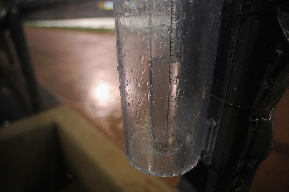
Showers and thunderstorms developed late Saturday night across Minnesota, and continued to redevelop over the same areas through late Sunday, creating some hefty rainfall totals.
The heavy rainfall prompted the National Weather Service to issue Flash Flood Watches and Flash Flood Warnings for areas primarily in Southern Minnesota, as some small streams and roadways flooded.
Good news: a dry, sunny, and much more comfortable week is on the way.
24-Hour Minnesota Rainfall Totals for Saturday & Sunday
- Mankato: 8.65 inches
- Fairfax: 8.00 inches
- Gibbon: 7.64 inches
- St. Peter: 6.95 inches
- Morristown: 6.35 inches
- Kasota: 6.25 inches
- Redwood Falls: 5.39 inches
- New Ulm: 5.01 inches
Closer to Home
- Elk River 2.58 inches
- Milaca: 2.18 inches
- Clearwater: 1:54 inches
- Sauk Rapids: 1.27 inches
- Rice: 1.27 inches
- Kimball: 1.12 inches
- Princeton: 1.02 inches
- Sartell: 1.00 inches
The forecast for Central Minnesota for this week looks much drier with cooler temperatures. Sunny skies are on the Central Minnesota weather menu through Friday, with high temperatures right around 80° each day.
Normal high temps for this time of year in Saint Cloud are just above the eighty degree mark.
Both the thirty and ninety day outlooks for Central Minnesota are calling for near to slightly above normal temperatures, with a better chance for above normal precipitation.
Pete Hanson is on 98.1 Minnesota's New Country weekday mornings from 5:30 to 10:00.

This Secret 4th of July Parade is One of the Best in Central Minnesota
More From 98.1 Minnesota's New Country