See Minnesota Counties With Most Coronavirus Cases [New Map]
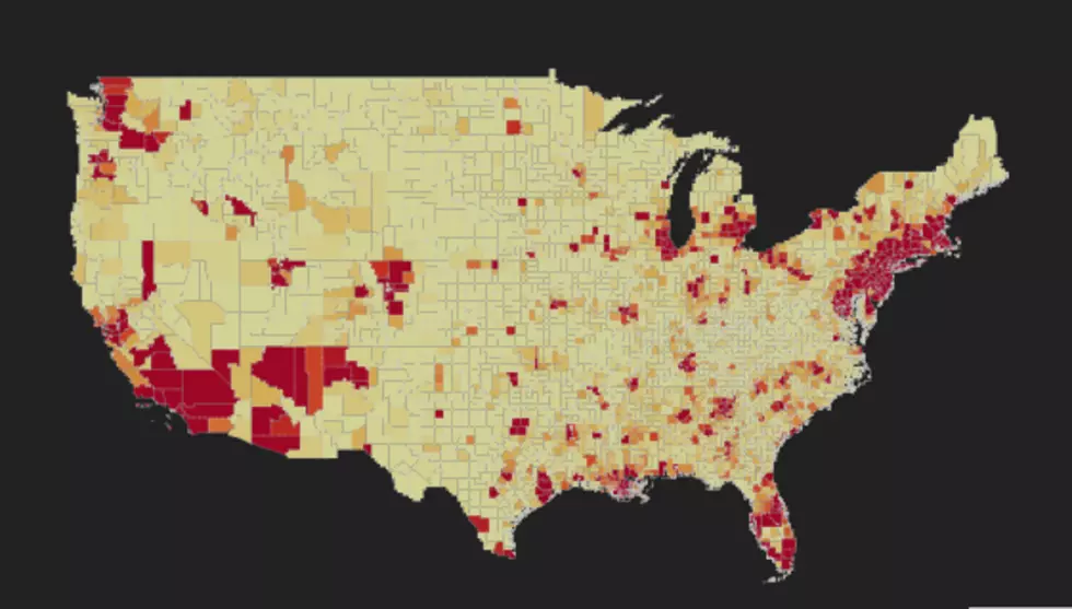
Johns Hopkins University has followed up its fascinating and viral COVID-19 interactive world map with the COVID-19 United States map. Just like its predecessor, this map allows you to zoom in and out and move all around the country.
The United States map shows us the number of confirmed cases, deaths, and fatality rates by county. And much Johns Hopkins University's world map, it is packed full of information and very educational. And we could all use more of that.
When you look around at the entire country, not surprisingly, the darkest areas are the east and west coasts. Minnesota and the whole of north-central parts are almost all lighter shades. Minnesota ranks as one of the lowest in the country.
Minnesota counties with the highest amount of confirmed cases (as of 4/21/20):
- Hennepin County: 1,013
- Ramsey County: 215
- Olmsted County: 198
- Dakota County: 127
- Nobles County:101
Central Minnesota:
- Wright County: 27
- Stearns County: 18
- Sherburne County: 13
- Benton County:4
- Todd County: 3
The map updates each evening at 7 pm.

Get more information about COVID-19 from the WHO, CDC, and the M.N. Health Dept.
The World Health Organization (WHO)
U.S. Center for Disease Control and Prevention (CDC)
(Source: Johns Hopkins University)
10 Things to Say to a Minnesotan to Make Them Mad
More From 98.1 Minnesota's New Country