Crazy Clouds Spotted Near Foreston During Storms on Wednesday
When I woke up for work at 4 am on Wednesday, July 8th I looked outside and saw pink as the sun came up. I've always heard "pink sky at morning sailors take warning", but I didn't think it would be more than just some light rain showers and some heat lightening. After all, there was a heat advisory set for today.
A look at the weather radar indicated otherwise.
Before 8 AM I had been sent four special weather statements and seen that Wadena had a tornado warning. My mom had even sent me a video of crazy wind that was going through the Long Prairie area.
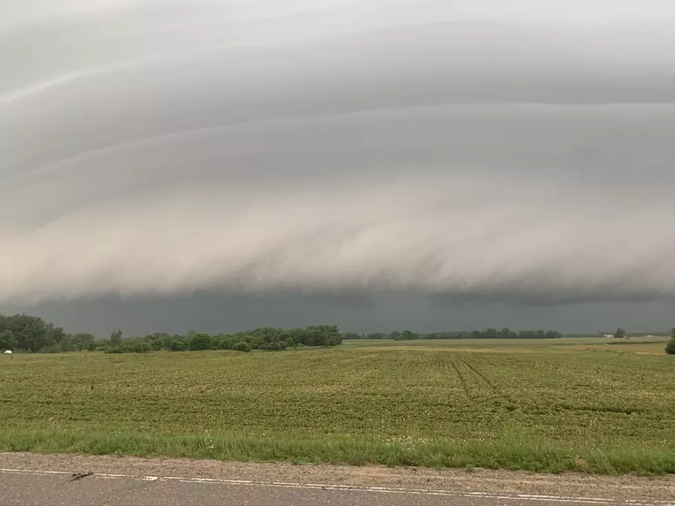
My fiance works road construction and had to head up to the Foreston area today for a project, and while he was there he got some pictures of intense looking clouds rolling through.
Storms over Foreston, Wednesday July 8th.
I got a follow-up message from him shortly after the cloud pictures saying that it was pouring rain.
More storms are set to happen Wednesday afternoon:
Thunderstorms are expected Wednesday afternoon into Thursday as a front passes. Severe storms are possible, primarily Wednesday afternoon into the evening, with the primary risks being gusty winds and large hail.
In addition to the storms there is a heat advisory in effect from 11 am - 8 pm on July 8th. Try to stay in the AC, stay hydrated, stay out of the sun if possible, and make sure you are checking on friends and relatives.
For the latest on the weather, be sure to have your 98.1 mobile app opted in for "weather" alerts.

10 Ways To Keep Cool on Hot Minnesota Days
More From 98.1 Minnesota's New Country


