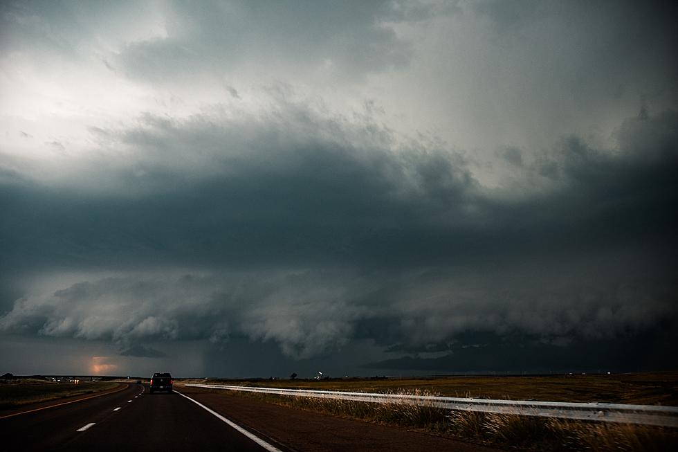
Severe Weather Possible Tonight
The National Weather Service says there's a risk of severe weather across parts of Central Minnesota tonight.
Essentially the western half of Minnesota is at risk for severe thunderstorms later today, with the risk increasing for Central Minnesota as the storms move east tonight. Damaging winds, large hail, heavy rain, and a tornado will all be possible.
The storms are not expected to reach the Saint Cloud area until after 8 PM . Thunderstorms are also likely off and on again Saturday and Sunday.
Following tonight's storms, Central Minnesota is in for a hot and muggy weekend. High temperatures are expected to creep near 90 in Saint Cloud on both Saturday and Sunday. Heat indices are expected to be in the nineties throughout the weekend.
High Temperatures for Saturday
- St. Cloud: 86°
- Little Falls: 85°
- Princeton: 86°
High Temperatures for Sunday
- St. Cloud: 87°
- Little Falls: 85°
- Princeton: 87°
The average high temps for this time of year are near eighty.
Be weather aware, and have a way to receive watches and warnings. Tune to 98.1 Minnesota's New Country for weather alerts.
From the National Weather Service this morning: There is a chance for strong to severe storms this afternoon in west central Minnesota, with the chance spreading east and south through the evening. Heavy rain will also be possible.
Pete Hanson is on 98.1 Minnesota's New Country weekday mornings from 5:30 to 10:00.
Foods That Could Kill Your Dog or Make Them Very Sick
More From 98.1 Minnesota's New Country