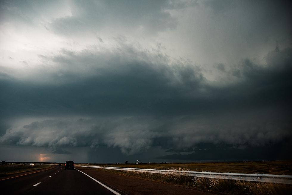
Severe Weather Possible this Afternoon & Evening in Central Minnesota
The National Weather Service says there's a risk of severe weather across central and eastern Minnesota this afternoon and evening.
Afternoon and evening storms could have the capability of producing damaging wind gusts in excess of 70 mph, large hail of 2 inches or greater, and a few tornadoes. The risk of severe weather increases farther to the south and east of our area.
The most likely time of arrival of storms in the Saint Cloud area looks like late this afternoon through the evening hours.

Tonight's St. Cloud Forecast: A 40 percent chance of showers and thunderstorms, mainly before 10pm. Some storms could be severe, with large hail and damaging winds. Partly cloudy, with a low around 67. North wind 5 to 10 mph.

From the National Weather Service this Morning: An outbreak of severe thunderstorms will occur later today. Storms will develop this afternoon across northern Minnesota, become a line and accelerate southeastward across Wisconsin during the evening. Widespread wind damage, very large hail, and a few tornadoes are expected with the line of storms. Have a way to receive warnings and be prepared to seek shelter quickly with these fast moving storms.


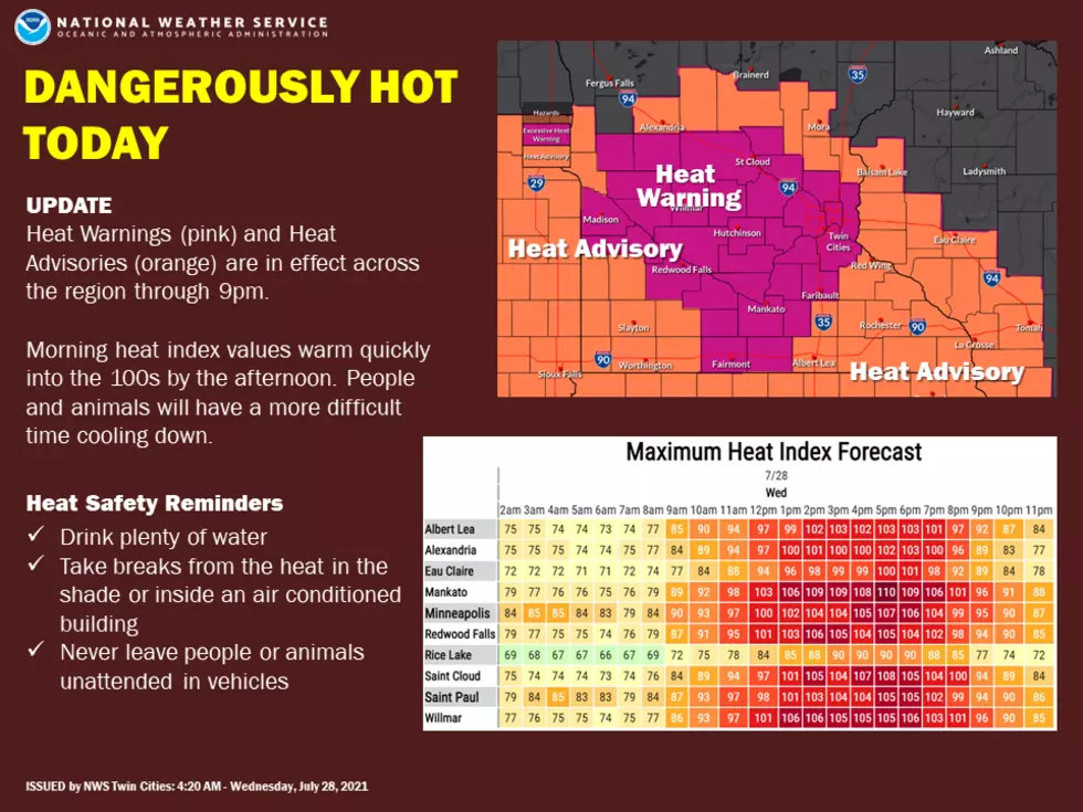
Dangerous Heat for One More Day
An Excessive Heat Warning has also been issued for the Saint Cloud area through 9 pm tonight, when dangerously hot conditions with heat index values up to 110 will be possible.

Be weather aware, and have multiple ways to receive severe weather warnings.
TIPS: Here's how you can prepare for power outages
LOOK: The most expensive weather and climate disasters in recent decades
Gallery Credit: KATELYN LEBOFF
KEEP READING: Get answers to 51 of the most frequently asked weather questions...
More From 98.1 Minnesota's New Country