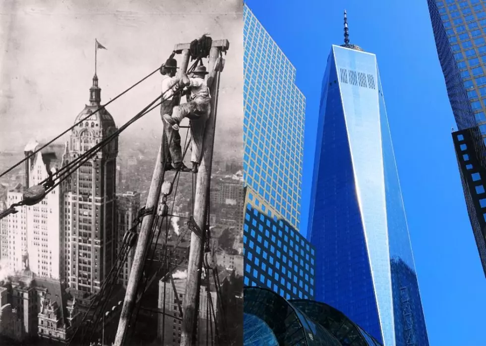
Major U.S. City Skylines in Photos, Then and Now
Today, certain city structures across America have become synonymous with the skylines they dot, from Seattle's Space Needle to Chicago's Willis Tower and New York City's Empire State Building. While they may now be indelible markers in their metros, these buildings are relatively new. After all, it wasn't until the late 19th century that cities in the United States started to grow at a dramatic rate.
ALSO SEE: How Much Was Gasoline the Year You Started Driving?
The Electric Avenues of America
Increasing industrialization in the 19th century spurred that growth, with the development of electric power and steam engines resulting in factories no longer needing to be located near rivers. Instead, they could be in urban areas, drawing even more people into those cities with the promise of steady, though often difficult, jobs.
By the turn of the 20th century, many American cities had distinct identities based on their particular industry. New York served as the national hub for finance, Chicago was a major meat processing base, Los Angeles became a center for film production, and so on. These distinctions only grew as urbanization continued, with the different industries marking the physical landscapes of their cities in specific ways.
RELATED: The Longest Highways in America
A Drastic Makeover for America's Cities
Of course, U.S. cities today look radically different than they did a century ago—but what do these differences reveal? How did these changes develop, and how did they affect various cities? Did certain cities expand organically over time, or did they multiply due to technological advancements like Edison's electric lightbulb? To answer some of those questions, Stacker parsed through photo archives and consulted the Council on Tall Buildings and Urban Habitat to find out what 15 major U.S. city skylines looked like about a century ago compared to how they stand today.
LOOK: Major US city skylines in photos, then and now
Gallery Credit: Stacker
LOOK: See how much gasoline cost the year you started driving
Gallery Credit: Sophia Crisafulli

More From 98.1 Minnesota's New Country