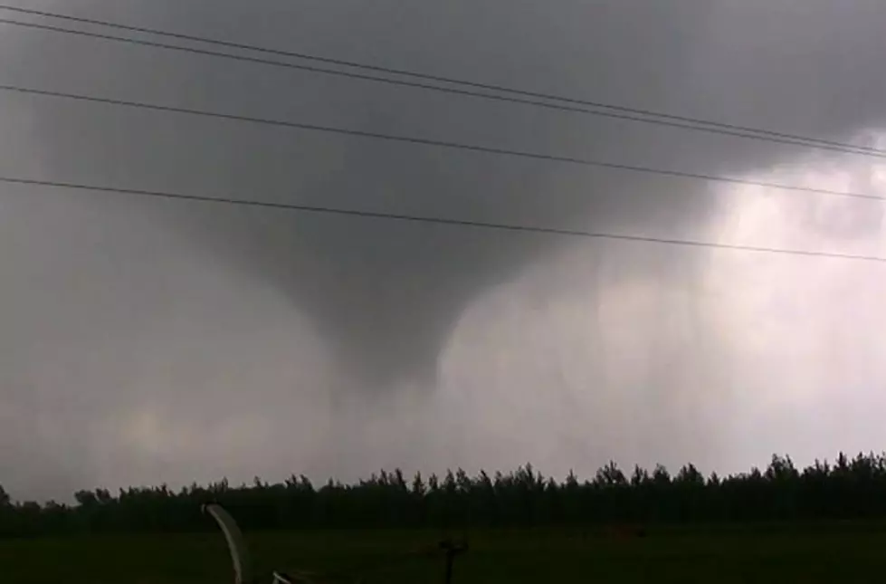
![Funnel Cloud Caught on Video Near Gilman Monday [WATCH]](http://townsquare.media/site/65/files/2022/05/attachment-Untitled-design-2022-05-10T055242.323.jpg?w=980&q=75)
Funnel Cloud Caught on Video Near Gilman Monday [WATCH]
Monday brought us a taste of severe summer weather in Central Minnesota. The morning started off with rain, wind, and hail, and the afternoon brought humidity and the threat of tornados.
There was a funnel cloud caught on camera Monday afternoon near Popple Creek. According to Central MN WX on Facebook, it did touch down near Gilman for about five minutes.
According to Tim Johnson, the man who submitted the video, the funnel cloud had started as a wall cloud, and formed into a funnel. He said he had watched it form for about 10 minutes.
Overall it was a bumpy afternoon for weather across Central Minnesota:
Radar-indicated rotation prompted a pair of tornado warnings in Benton, Sherburne, Morrison, and Mille Lacs Counties. The first warning was at 4:42 p.m. The storm was located 7 miles West of Foley moving Northeast.
The National Weather Service says there is a chance of more severe weather this week, especially Wednesday afternoon and evening, and again Thursday afternoon. We will keep you up to date with the latest forecast on our station mobile app. Be sure to download it to your phone and opt it in for weather alerts.

How To Plant Your Own Hanging Flower Baskets
10 Commandments of Attending a Minnesota BBQ
More From 98.1 Minnesota's New Country


![139 Years Ago: F4 Tornado Devastates Sauk Rapids, Area [PHOTOS]](http://townsquare.media/site/67/files/2025/04/attachment-CycloneNews011.jpg?w=980&q=75)