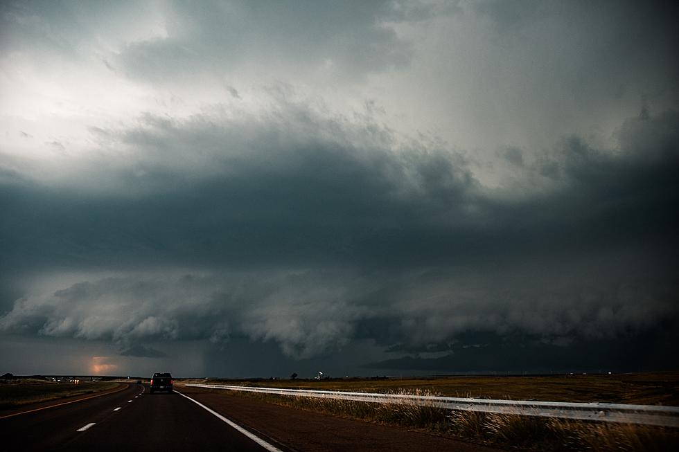
Elevated Severe Weather Threat This Afternoon & Evening
The National Weather Service says there's an enhanced risk of severe weather across parts of Central Minnesota today.
Damaging winds, large hail, heavy rain, and isolated tornadoes will all be possible. The timing for the main threat of the severe weather for Saint Cloud appears to be 4 PM and later.
The threat of severe storms will extend into the evening hours, with the main threat wrapping up by 10 PM.
Following today's storms, Central Minnesota is in for a beautiful stretch of fall-like weather with low dew points and cool days, with highs Saturday through the next week in the mid to upper seventies.
High Temperatures for Saturday
- St. Cloud: 78°
- Little Falls: 77°
- Princeton: 77°
High Temperatures for Sunday
- St. Cloud: 77°
- Little Falls: 77°
- Princeton: 77°
High Temperatures for Monday
- St. Cloud: 74°
- Little Falls: 74°
- Princeton: 74°
The average high temps for this time of year is just below eighty.
Be weather aware this afternoon and evening, and have a way to receive warnings! Tune to 98.1 Minnesota's New Country for weather alerts.
From the National Weather Service this morning: The Storm Prediction Center has upgraded today's outlook to 'Enhanced' across our region for this afternoon and evening. A few tornadoes and hail (some hailstones over 2") are possible. There is also a good chance of damaging winds. Please pay attention to the forecast and have a way to receive severe weather warnings.
Pete Hanson is on 98.1 Minnesota's New Country weekday mornings from 5:30 to 10:00.
10 Things to Look Forward To This Fall in Minnesota
More From 98.1 Minnesota's New Country